Sports
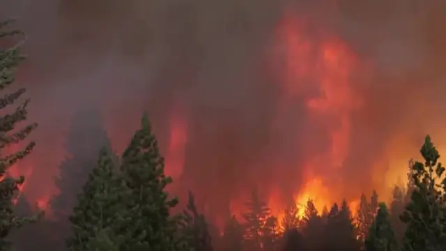
Ratepayers on the hook for $1.7 billion unpaid bill for Kincade, Dixie fires, regulatory judge decides
By Katherine Langford
Advertisement · Why this ad?
Marcus manages the day-to-day editorial workflow across all brands, coordinating coverage assignments and ensuring editorial standards are met. He previously served as city editor at the Pioneer Press and holds a degree in Political Science from Carleton College.
More from Marcus →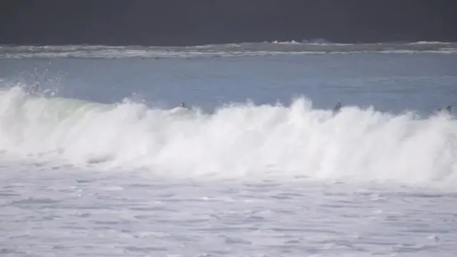
The familiar scent of eucalyptus and the promise of sunshine seemed a distant memory this Thursday as the Bay Area braced for a Level 2 storm, bringing rain, dangerous surf, and a welcome blanket of snow to the Sierra Nevada. This system, upgraded from earlier forecasts, signals the end of fire season and ushers in a period of potentially hazardous conditions for coastal communities and mountain travelers. The National Weather Service issued a high surf warning Wednesday, extending it from 6 a.m. Friday to 4 a.m. on Sunday, November 15th, specifically for the North Bay, San Francisco, Peninsula, Monterey Bay and Big Sur areas.
A Level 2 storm is expected to impact the Bay Area Friday, bringing gusty winds, potentially dangerous surf along the coast, and the first accumulating snow of the season to the Sierra Nevada mountains. According to ABC7 meteorologist Drew Tuma, this system will end the region's fire season. The forecast predicts about a half-inch of rain for most Bay Area cities, with higher amounts possible in the North Bay and Santa Cruz Mountains. Rainfall totals are expected to range from 0.50 to more than 1.5 inches, accompanied by wind gusts of 30 to 50 mph. The heaviest rain and strongest winds are predicted between 10 a.m. and 2 p.m. Friday, with showers continuing into the afternoon and a chance of thunderstorms.
Along the coast, forecasters are warning of increasingly dangerous conditions as surf builds through Friday. A Beach Hazards Statement remains in effect through Friday afternoon, escalating to a High Surf Warning as waves of 20 to 30 feet are expected to slam Bay Area beaches through Saturday. The National Weather Service cautions that these “dangerously large” waves pose a significant risk of drowning and coastal erosion, urging residents to avoid entering the water or approaching coastal structures. “These waves bring tremendous power that will overpower anyone in the water and cause coastal erosion. The risk of drowning is very high this weekend,” the weather service said in its forecast discussion.
Pacifica surfer Craig Garza expressed his anxieties, stating, “The water's getting aggressive. It's growing. The swell is increasing.” He emphasized the unpredictable nature of ocean conditions, warning, “It could look flat. It could look calm. And then all of a sudden, here comes 3 or 4 giant waves, and they push way up high on shore. And if you're not careful, you'll get pulled out.” Curtis Wedge echoed Garza’s concerns, urging caution and advising parents to keep children away from the water’s edge: “Don't let your kids out anywhere near the water. These tides will suck them kids right out. It’s dangerous.” Officials urge residents to heed the Beach Hazards Statement and High Surf Warning, avoiding all water activities and staying well away from the shoreline. The National Weather Service has emphasized that sneaker waves—unexpected, powerful surges—can arrive without warning, sweeping people into the ocean even when conditions appear calm. They recommend never turning one’s back on the ocean and being aware of potential coastal flooding risks.
The Sierra Nevada is also bracing for significant snowfall. Forecasters predict 6 to 12 inches of snow at lake level, with the potential for over 18 inches at higher elevations, marking the first accumulating snowfall of the season. This influx of snow will be a welcome sight for winter sports enthusiasts, but also underscores the need for drivers to prepare for potentially hazardous mountain travel conditions. Ahead of the high surf warning, the coast remains under both a beach hazards statement and coastal flood advisory that will be in effect through Friday afternoon. Forecasters said breaking waves of 15 to 20 feet are expected on Thursday and Friday. Meanwhile, up to 1.5 feet of tidal inundation in low-lying coastal areas is possible during high tide.
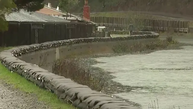
In addition to the high surf warning, a coastal flood advisory is in effect through Friday afternoon, warning of potential tidal inundation in low-lying coastal areas. Forecasters predict up to 1.5 feet of tidal inundation, emphasizing the need for residents in vulnerable areas to take precautions and monitor local alerts.
The storm is expected to continue impacting the region through Sunday, with another cold front anticipated to arrive Monday. Forecasters predict rainfall amounts under an inch for both fronts. Residents should monitor weather updates from the National Weather Service and be prepared for potential disruptions to daily routines, including hazardous driving conditions and possible flooding in low-lying areas. The City of Atherton’s emergency services department is closely monitoring the situation and will issue alerts as needed; residents are encouraged to sign up for local emergency notifications through the city's website: City of Atherton Website.
The arrival of this storm serves as a stark reminder of the power and unpredictability of nature, and underscores the importance of community resilience and preparedness. While the rainfall offers much-needed relief from drought conditions and the Sierra snowpack promises a good water supply next year, the dangerous surf poses a real threat to families who enjoy our coastline. It's easy to become complacent when we experience stretches of calm weather, but these warnings are critical – particularly for parents.
Residents seeking more information or assistance can access the following resources:
The National Weather Service Bay Area office can be followed on Twitter at @NWSBayArea for real-time updates.
The Atherton emergency services department can be reached at (650) 283-3800.
It’s a blessing to live in a community that values safety and preparedness, and the coming days offer a chance for neighbors to look out for one another as this storm passes through.
As the Level 2 storm approaches, residents should remain informed and vigilant, prioritizing safety and supporting one another through potentially challenging conditions. The spirit of resilience and community that defines Atherton will undoubtedly see us through this weather event and into a brighter future.
Sausalito, California
Sports
Thursday, November 12, 2026
5 min
By Katherine Langford

By Marcus Chen

By Katherine Langford
By Marcus Chen